

Red Rock Wonders: Exploring Valley of Fire State Park in Nevada
Valley of Fire State Park is less than an hour’s drive from the bright lights of Las Vegas, and it feels like a different world entirely.
The park is Nevada’s oldest and largest state park, and in my humble opinion, one of the very best state parks in the United States. Valley of Fire gets its name from the vibrant red Aztec sandstone that glows under the sun, creating an almost surreal, fiery landscape.
It has a little bit of everything: dramatic red sandstone formations, ancient Native American petroglyphs, exceptional wildlife viewing opportunities, and sprawling desert vistas along beautiful hiking trails.

Visiting Valley of Fire State Park
My wife and I visited Valley of Fire State Park in the fall. We’d spent the past week exploring Utah and were on our way home, but had budgeted most of the day to explore the park. It was our first time visiting, and to say we were excited was an understatement.
We spent the night prior in St. George, Utah, and left in the dark so we could make the hour-and-a-half drive in time to arrive at dawn. Coming from the north, we entered the park through the east entrance. To my surprise, there was not another car in sight; in fact, we would not see any other visitors for our first couple of hours in the park.
Below is a list of all the things we did in one full day at Valley of Fire. These are not ranked by what we like the most or think was the best, because honestly, it was all pretty amazing.
Instead, I mapped it out in order, so if you were to enter on the east side, you could follow our approach.
One Day in Valley of Fire State Park: An Itinerary
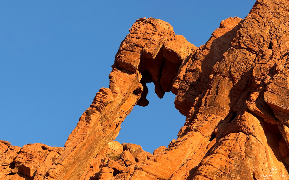
Hike to Elephant Rock
After entering the park, we pulled into the parking lot for Elephant Rock. The natural arch resembles an elephant and is one of the most photographed features in the park due to its easy accessibility. A short trail gives an up-close view, but you can also see it from the park road.
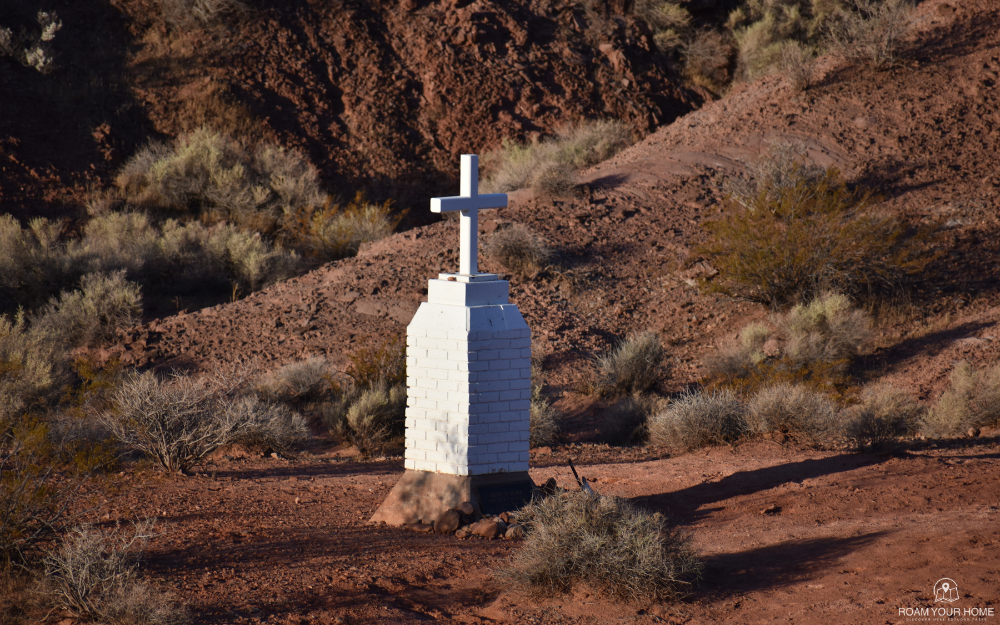
John G. Clark Memorial Cross
A short bit down the road from Elephant Rock, we came to the Clack Memorial Cross.
The memorial was built in 1949 to honor Captain John G. Clark, a Civil War veteran who emigrated to California after the war.
The story goes that Clark was traveling from Bakersfield to Salt Lake City on a carriage when he stopped in the Valley of Fire. He tied his horse to the wagon and went in search of water. Without finding any, we crawled under the wagon and died, likely from thirst. His body was found several days later on Jun 30, 1915.
The white memorial is located a couple of hundred feet off the road, but it can be clearly seen.
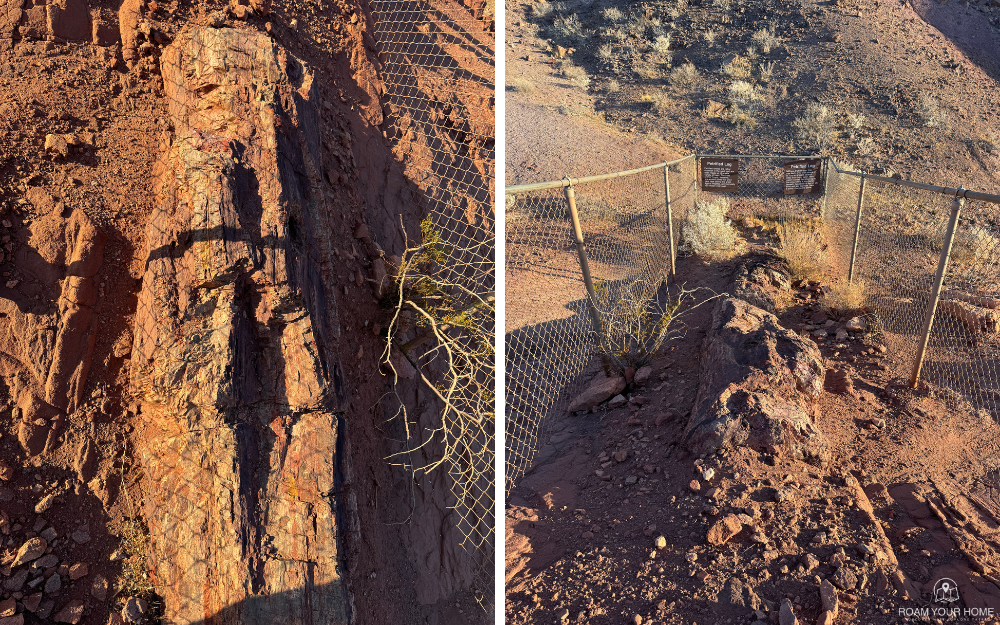
Petrified Log
Also along the main park road, just past the Memorial Cross, is the Petrified Log. The giant log is a short hike with a slight elevation change. The entire loop is only 0.3 miles long, making it great for stretching your legs while checking out a fascinating geological feature.
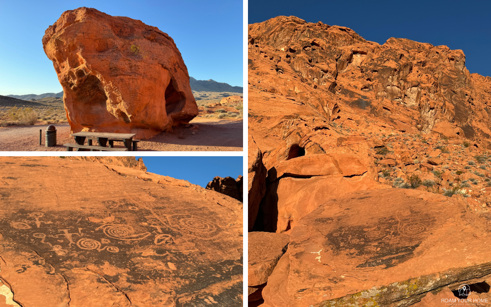
Lone Rock
Next up for us was the Lone Rock Picnic Area just off the main park road. As the name suggests, it is a large rock sitting by itself. However, it would be foolish just to drive by because right beside it are some incredible petroglyphs.
This is a great spot to take a moment to relax. There is a picnic table where you can sit and grill if you want to make snacks.
Historic CCC Cabins
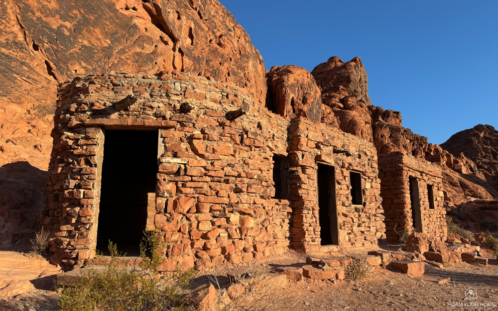
Down the road from Lone Rock are a series of historic cabins. The three cabins were built by the Civilian Conservation Corps shortly after it became a state park in 1935. The cabins are made from native sandstone and have been used to shelter visitors to the park for many years.
You can’t sleep in them anymore, but you can walk through them. It was cool to imagine spending the night in them 70 years ago! The stories the walls would tell. There are petroglyphs visible near the cabins.
Seven Sisters
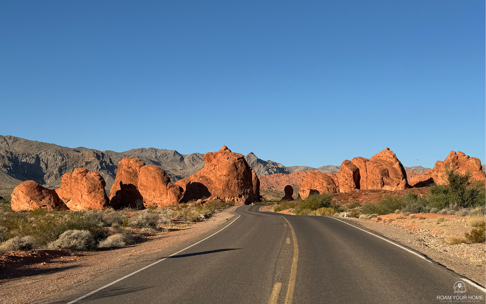
Returning to the main park road, we pulled into the Seven Sisters Viewpoint next. Here, we have a great view of seven giant free-standing boulders.
There are covered picnic tables and vault toilets available here. Next, we pulled into the parking lot for the Visitor Center, which was still closed at the time. There were a few desert bighorn sheep having breakfast nearby.
Drive Mouse’s Tank Road
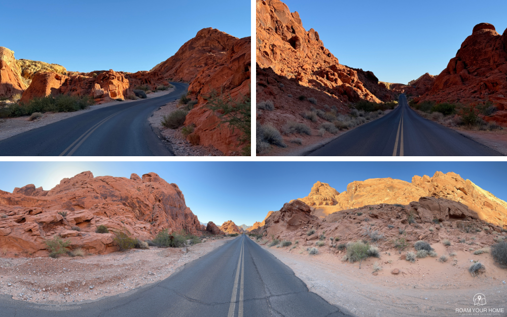
Not wanting to wait around until the V.C. opened, we decided to head down Mouse’s Tank Road, passing Balancing Rock along the way. This incredible drive passes through some of the park’s more breathtaking scenery. The road weaves through red rock canyons and cliffs. Many iconic photos of the Valley of Fire are taken along the route. I know we certainly stopped for plenty.
Hike the Fire Wave Trail
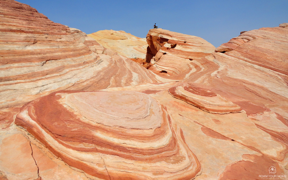
At nearly the end of the road, we hiked what is probably the most famous and iconic trail in the park, the Fire Wave Trail. The 1.5-mile round-trip hike to a stunning wave-like formation of swirling deep red, white, and pink sandstone.
This hike is quite exposed and can get quite hot. We were still relatively early in the day, and it was still hot! The park closes the area due to high temperatures from June 1 to September 30.
If you have the time, White Domes Trail is nearby and is supposed to be incredible. We didn’t hike that one, but based on what we’ve read, it seems to offer a great mix of desert views, slot canyons, and other beautiful scenery.
Photo Credit: Fabio Achilli
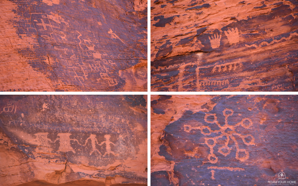
Mouse’s Tank Trail – Petroglyph Canyon
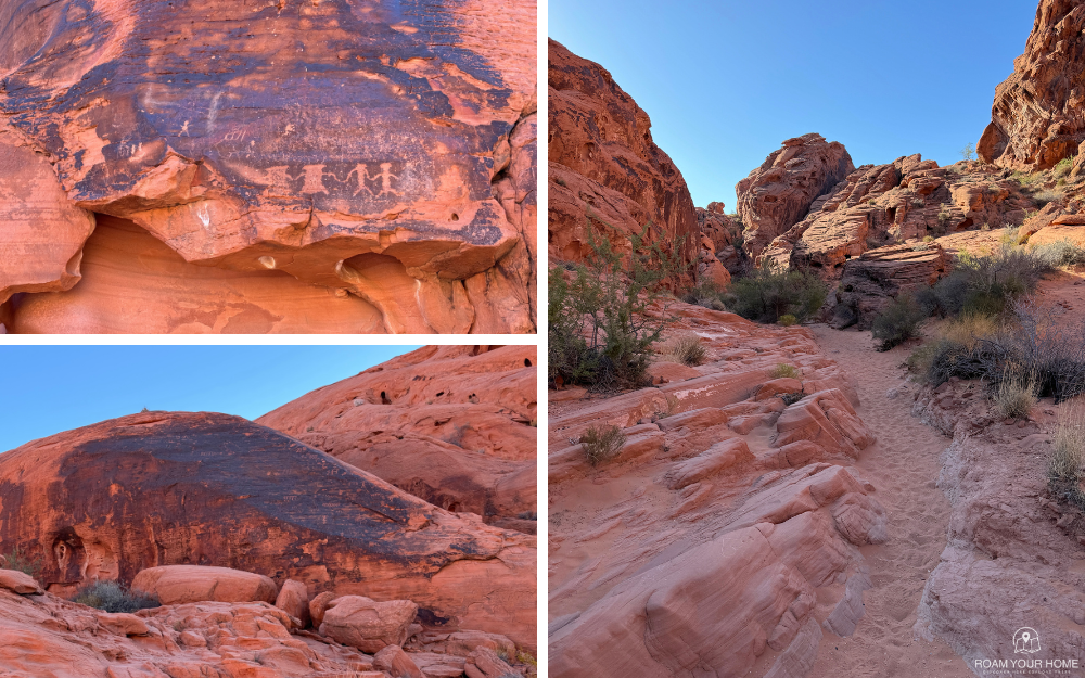
From the Fire Wave, we headed back out towards the main park road, but first, we both wanted to hike the Mouse’s Tank Trail. It’s a three-quarters-of-a-mile out-and-back trail. The trail is flat, but very sandy in places.
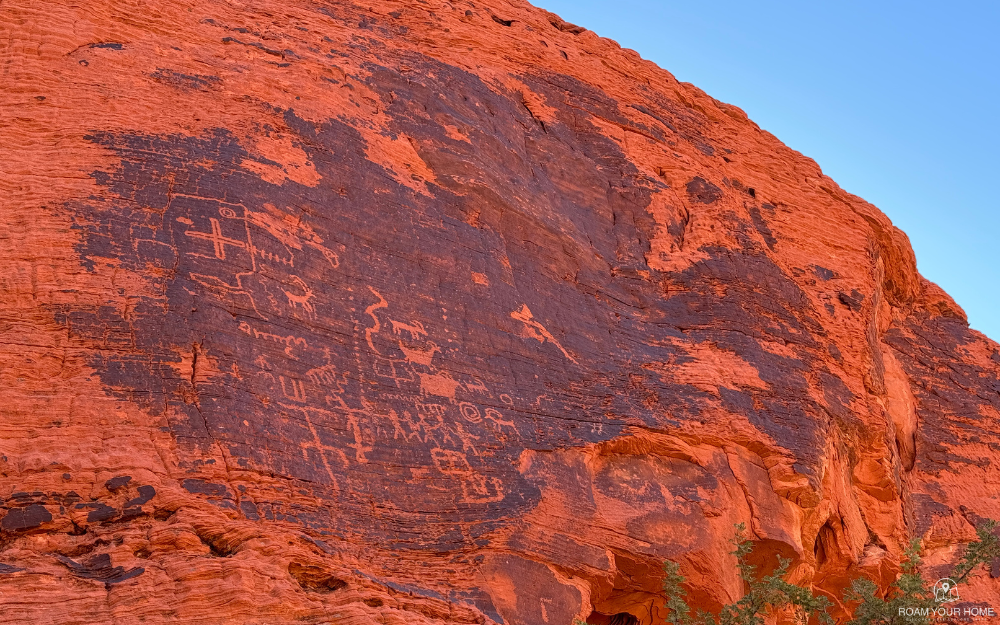
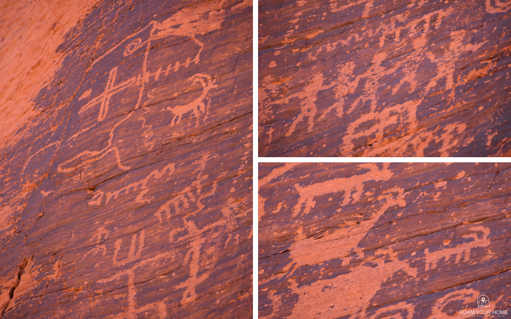
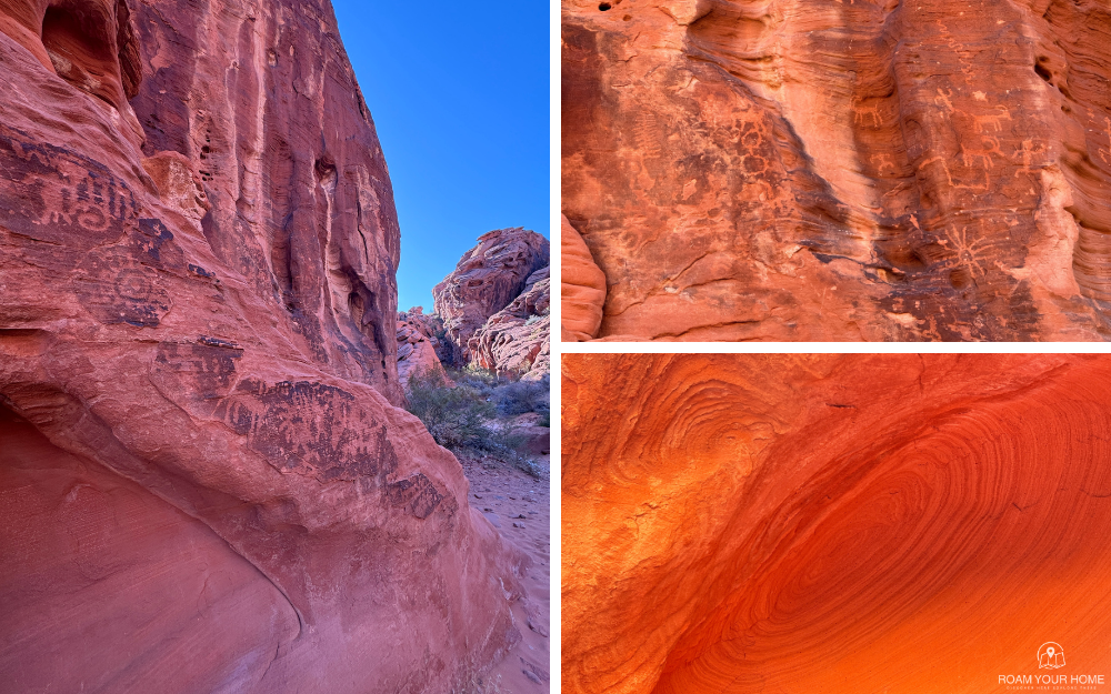
A little sand in the shoes was a small price to pay for the reward. Mouse’s Tank was a small pool of water at the end of the trail that was quite pretty, but the big highlight for us was the amazing display of rock art. There are petroglyphs all along this hike! In fact, there are more than 800 on the canyon walls! It’s the largest collection of petroglyphs in Nevada.
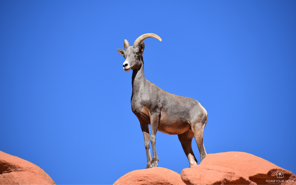
Some are faint and hard to see, while others are etched into the dark, deep red walls and are very easy to see. My wife and I were honestly amazed by just how many were visible! In particular, there were bighorn drawn into the walls just about everywhere they were visible, which would make a lot of sense when we got to our next stop.
The Visitor Center
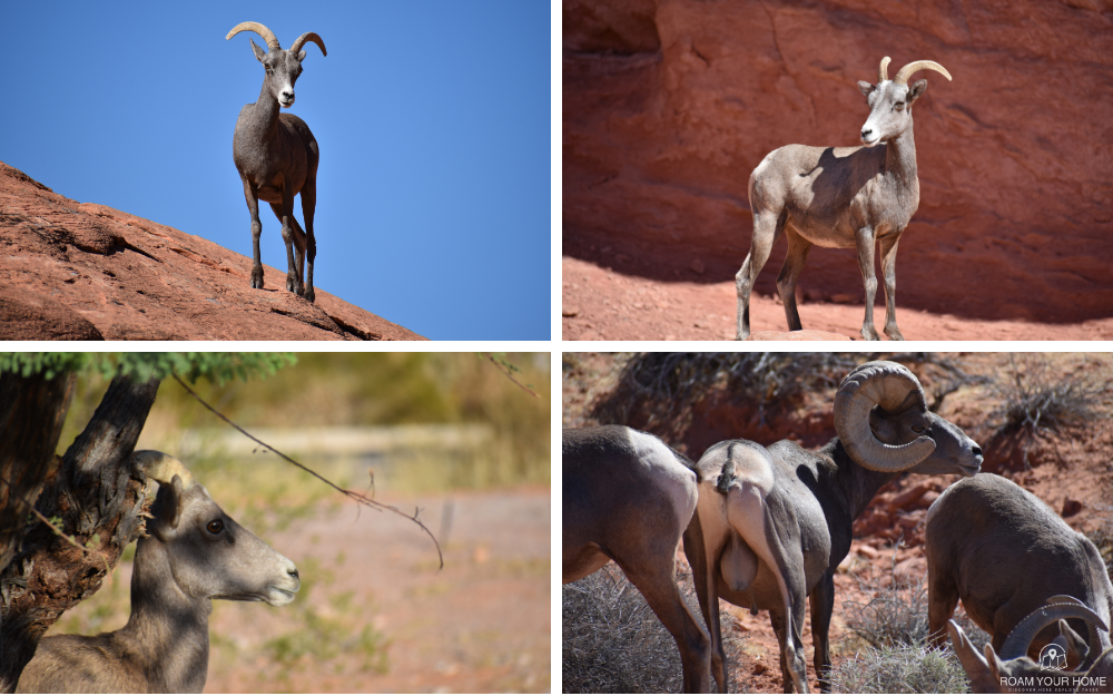
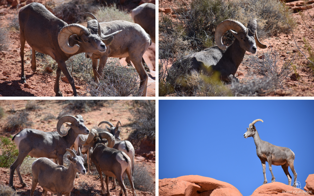
After enjoying the rock art, we made our way back to the Visitor Center, which had just opened about half an hour before we got back there. The parking lot was still basically empty, but bighorn sheep now filled many spots.
What had been a few sheep having a snack turned into dozens roaming about, and some of the adult rams had massive, full curls.
We spent about 45 minutes simply watching the wildlife and taking too many pictures. There were also a few notable exhibits in the Visitor Center worth checking out.
I asked a ranger if it’s common to see so many bighorn sheep. She replied, “There may be a few more than normal today, but generally speaking, if you spend enough time in the park on cooler days, you will see a few. They are here often.”
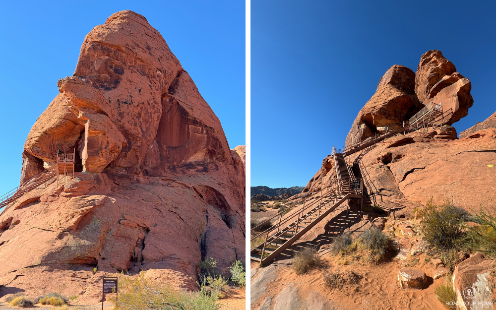
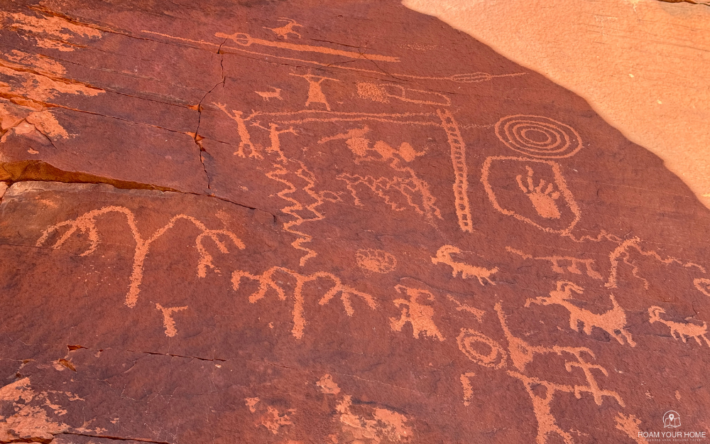
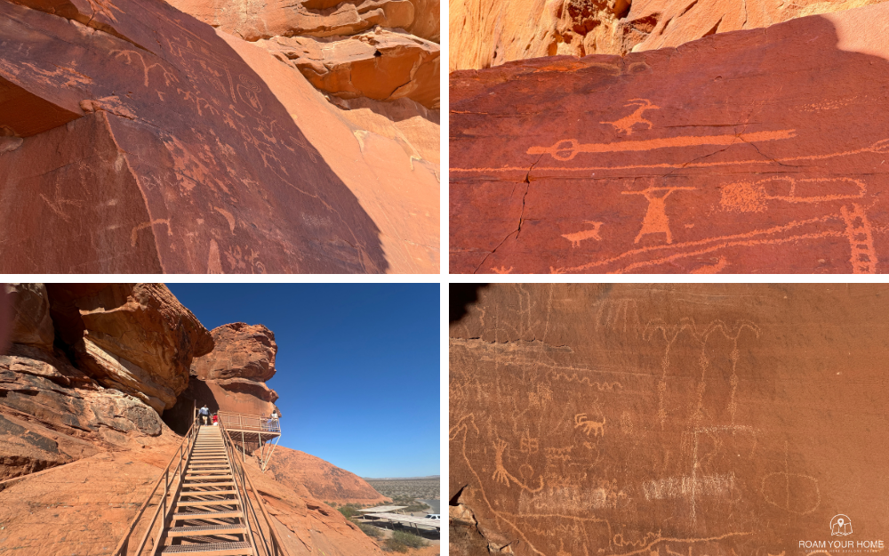
Petroglyphs at Atlatl Rock
Leaving the V.C., we headed over to Atlatl Rock to check out more ancient Native American rock art. The park was getting busier now. The parking lot here was about halfway full.
To see the petroglyphs at Atlatl Rock, you have to climb a steep set of metal stairs. The rock art here is believed to be more than 200 years old.
The petroglyphs are situated high on the rock and are remarkably well-preserved. You can clearly make out the “Atlatl,” which is a tool that was used to allow for greater velocity when throwing a spear or dart, by acting as an extension of the thrower’s arm.
The Atlatl petroglyph is how this area got its name.
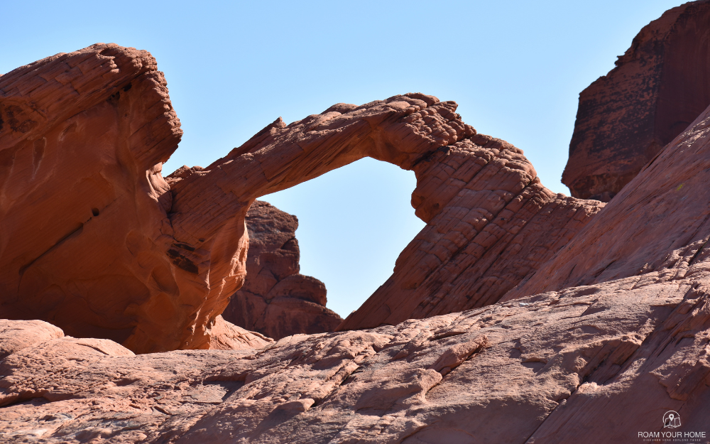
Arch Rock
Arch Rock is just around a bed from Atlatl Rock. This was a great stop with a fantastic view of a natural arch. The sun was up a little high in the sky by now, but there was still a slight glow on the underside of the arch. It reminded me a bit of Mesa Arch in Canyonlands National Park at sunrise, just not quite as dramatic.
From here, you can finish the loop and check out the Beehives Rock Formations and another spot with petrified logs.
We also drove through the Atlatl Rock Campground, and it looks very nice! Nice sites surrounded by giant red rock boulders.
By this point, it was nearing the afternoon, and the temperature had exceeded 100 degrees. We decided to move on, but not without making a promise of a return visit the next time we are in the area.
Valley of Fire State Park delivers some of Nevada’s most dramatic landscapes. Our visit was unforgettable, with amazing views, history, wildlife and outdoor adventure in every direction.
Plan Your Visit to Valley of Fire State Park
Park Location
29450 Valley of Fire Road, Overton, Nevada, about an hour northeast of Las Vegas. The park is known for red sandstone formations, petroglyphs, scenic drives, and desert hikes.
Best Time to Visit
Fall through spring is the best time to visit. Summer can be extremely hot, so hiking is best avoided during the hottest part of the day.
Parking
Parking is available throughout the park at major trailheads, overlooks, picnic areas, the visitor center, and scenic stops.
Costs or Passes Needed
A Nevada State Parks entrance fee is required. There is a day-use fee.
Tours
This is mostly a self-guided park. The main experience is driving the scenic roads, stopping at overlooks, seeing petroglyphs, and hiking short desert trails.
Time Needed
Plan on 2 to 4 hours for a scenic drive and a few short stops. Allow a full day if you want to hike several trails and explore slowly.
Hiking
Popular stops include Fire Wave, White Domes, Mouse’s Tank, Atlatl Rock, Elephant Rock, and Rainbow Vista. Bring plenty of water, sun protection, and sturdy shoes.
Accessibility
Some viewpoints, picnic areas, and visitor facilities are easier to access, but many trails include sand, rock, steps, and uneven desert terrain. Check the official park site for current accessibility and trail details.
Nearby Stops
Nearby stops include Las Vegas, Lake Mead National Recreation Area, Hoover Dam, Overton, Moapa Valley, and Lost City Museum.
Official Website
Check the official Nevada State Parks website for current hours, fees, closures, camping, trail conditions, and park alerts.
Frequently Asked Questions
Is Valley of Fire State Park worth visiting?
Yes. It is one of Nevada’s most beautiful state parks, known for fiery red rock formations, petroglyphs, desert scenery, and easy access from Las Vegas.
How long should you spend at Valley of Fire?
Most visitors should plan on 2 to 4 hours, or a full day if hiking multiple trails.
Is Valley of Fire close to Las Vegas?
Yes. Valley of Fire is about an hour northeast of Las Vegas, making it a popular day trip.
What is the best hike at Valley of Fire?
Popular hikes include Fire Wave, White Domes, and Mouse’s Tank.
Can you drive through Valley of Fire?
Yes. Valley of Fire is very drive-friendly, with scenic roads, overlooks, petroglyph sites, and short trails


